Meet the Meteorologist
What's your favorite weather phenomena?
What got you interested in the weather?


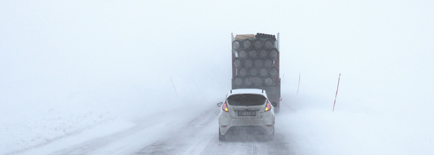
Some big changes are in store as we head through the remainder of Thanksgiving week as a wintry blast will make its presence felt across much of the Northern Plains, Midwest, Great Lakes, and even to the East Coast by late in the week.
First for Tuesday, a potent low pressure system will develop as it approaches the western Great Lakes bringing a swath of accumulating snow with the greatest travel disruptions expected across northern and eastern North Dakota, central into northern Minnesota, into far northern Wisconsin, and the Upper Peninsula of Michigan where snow totals from 2 to 8 inches are likely, with totals of a foot or more possible in far northern Wisconsin and Michigan's U.P. that see some lake enhancement. The accumulating snow will gradually come to an end Tuesday night for North Dakota but linger through Tuesday night for much of Minnesota, with the heavy snow still continuing Wednesday and Wednesday night for Michigan's U.P.
On the warmer side of this system, rain will spread from the Gulf Coast, through the Ohio River Valley, to the Northeast by later on Tuesday into Wednesday, which could also lead to delays on some of the busiest travel days of the year. Some severe thunderstorms also can't be ruled out from Louisiana, up through Mississippi, Alabama, Georgia, and into parts of southern Tennessee Tuesday into Tuesday night out ahead of a cold front. Damaging wind gusts, isolated instances of large hail, and even some tornadoes can't be ruled out with the strongest storms in this region.
In the wake of the low pressure system on Wednesday, much more wintry temperatures and windy conditions will prevail especially from the Dakotas eastward to the western Great Lakes where daytime high temperatures will struggle to get out of the 20s to low 30s and winds could frequently gust into the 30 to 40 mph range. This will lead to wind chill values as cold as the single digits above and below 0.
Downwind of the eastern Great Lakes, heavy lake effect snow will start to kick into high gear, especially Wednesday night into Thanksgiving Thursday from northeast Ohio, to northwestern Pennsylvania, to northern and western New York state. The gusty west to northwest winds could also lead to reduced visibility due to blowing snow.
Thanksgiving itself is looking dry for the Thanksgiving Day Parade in New York City, however it will be quite breezy. If sustained winds are greater than 23 mph and gusts are more than 34 mph the giant parade balloons cannot be flown as they become too difficult to control. If the winds do end up being light enough for the balloons to make their scheduled appearance, parade-goers will still want to dress for wind chills in the 30s.
Even as late as Black Friday accumulating lake effect snow is still possible downwind of the Great Lakes from Michigan all the way to upstate New York. Meanwhile, another potential storm is poised to create some more travel headaches for post-Thanksgiving travel, as yet another low pressure system could develop across the central Plains on Saturday and work northeastward into Sunday. While the exact details will become clearer in the coming days, the potential more southern track of this system could bring accumulating snow to areas like Nebraska, Iowa, and northern Illinois.

 Paul Trambley
 Derek Heit
 Jennifer Wojcicki
 Laura Lockwood
 Ray Miller